Magnitude 7.7 earthquake kills 53 and leaves more than 130 injured across Flores, Indonesia
A magnitude 7.7 earthquake struck Indonesia’s Flores Island on 15 August, killing at least 53 people and injuring 135, while landslides, damaged buildings and more than 1,500 aftershocks disrupted rescue efforts.
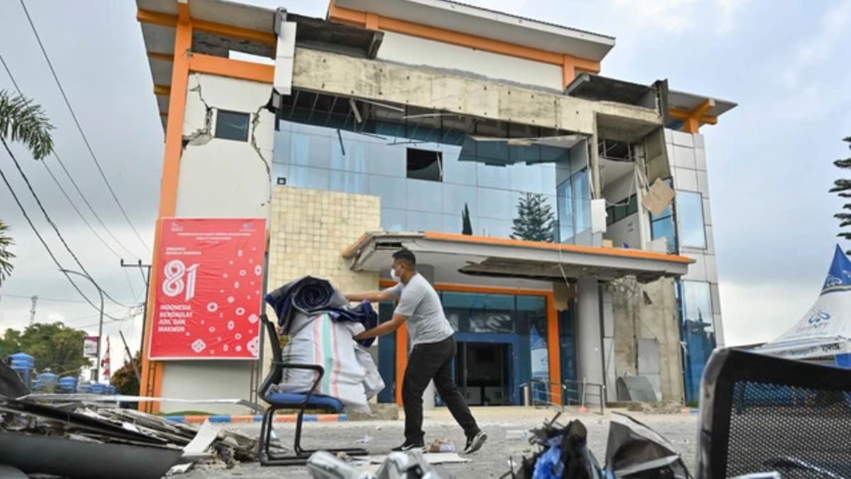
- At least 53 people were killed and 135 injured after the earthquake struck Flores Island.
- Landslides and structural damage disrupted roads, ports, homes and public facilities across several areas.
- More than 1,500 aftershocks were recorded as rescue and recovery operations continued.

A magnitude 7.7 earthquake struck Flores Island in East Nusa Tenggara (NTT), Indonesia, on Saturday, 15 August 2026, killing at least 53 people and injuring more than 130 others, according to the latest data from Indonesia’s National Disaster Management Agency (BNPB).
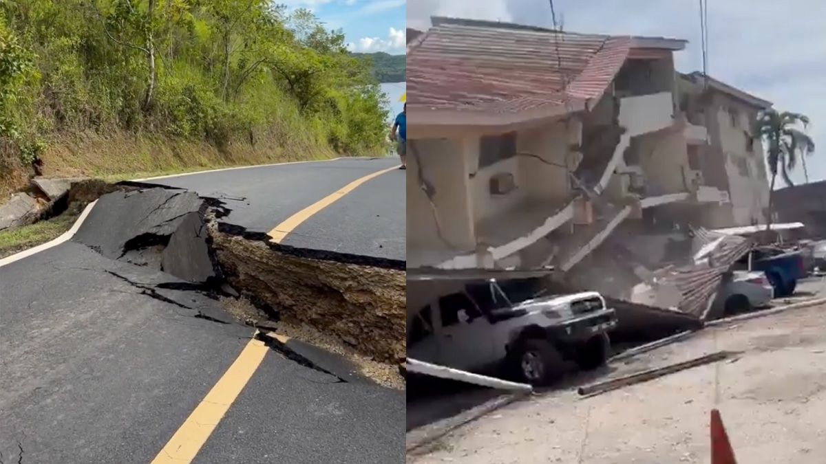
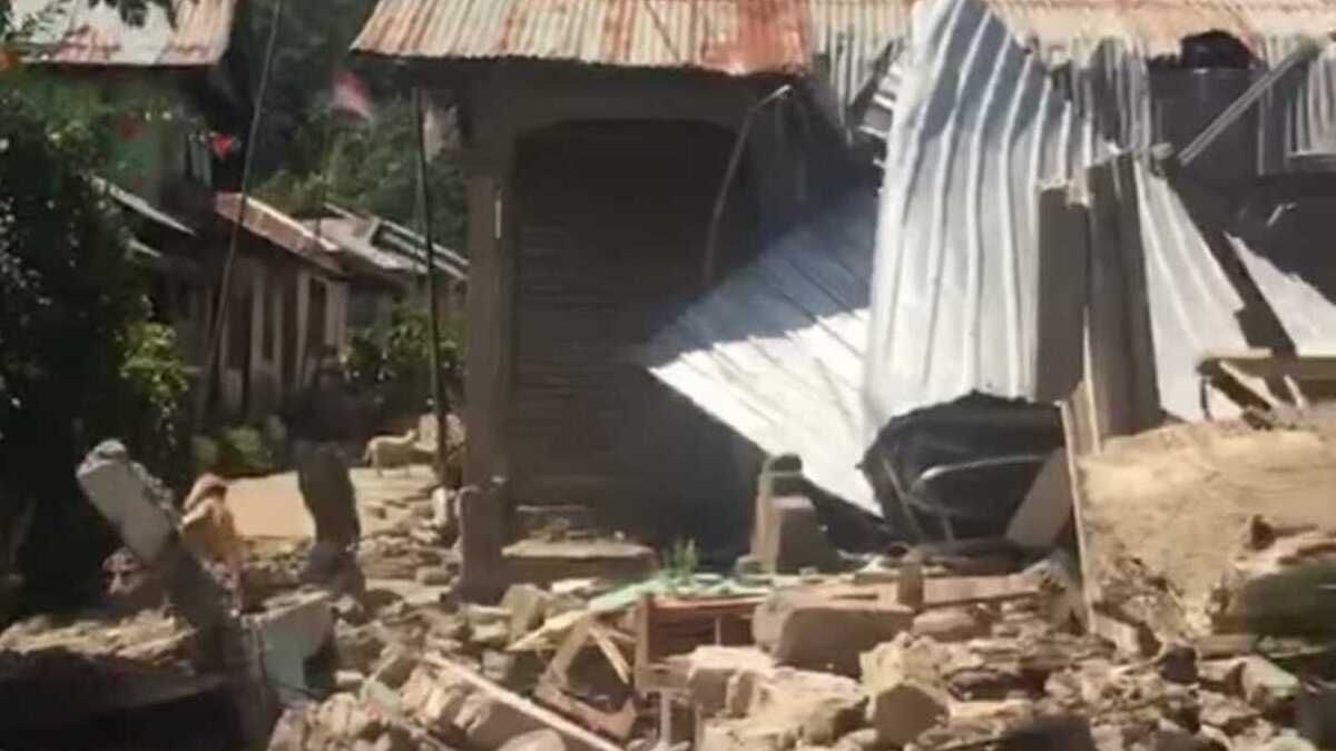
The earthquake caused widespread damage across several regencies on Flores, triggering landslides, disrupting roads and damaging homes, public facilities, ports and other buildings. Rescue and emergency operations continued as authorities assessed the scale of the destruction.
Earthquake centred near Nagekeo
The Meteorology, Climatology and Geophysical Agency (BMKG) said the earthquake was a shallow event with a depth of about 15 kilometres.
BMKG Deputy for Geophysics Nelly Florida Riama said the earthquake was associated with activity along the Flores Back-Arc Thrust.
An updated analysis placed the epicentre offshore at 8.41 degrees south latitude and 121.39 degrees east longitude, about 30 kilometres north-east of Nagekeo, East Nusa Tenggara.
The earthquake produced strong shaking across Flores. BMKG recorded intensity VI on the Modified Mercalli Intensity (MMI) scale in Wolowae, Nagekeo Regency, and Bajawa.
At MMI VI, the shaking is strong enough to startle people and cause people to run outdoors. The earthquake was also felt at intensity V in Ende, Borong and Ruteng, where it woke many sleeping people and was felt by almost all residents.
The earthquake was felt across Flores Island. A magnitude 6.4 aftershock was subsequently reported in Labuan Bajo, Manggarai Regency.
Death toll rises to 53
The latest BNPB figures put the death toll at 53, with victims recorded in six regencies on Flores.
The largest number of deaths was reported in Manggarai, with 25 fatalities, followed by East Manggarai with 20. Sikka recorded four deaths, Ende two, while West Manggarai and Nagekeo each recorded one death.
BNPB also reported that 135 injured people were receiving treatment at health facilities. The casualty figures remained subject to verification as search and rescue operations continued.
The latest death toll followed the recovery of six additional bodies by rescue teams. Search teams continued clearing rubble and landslides in areas where residents were believed to remain trapped.
Tsunami warning issued after earthquake
BMKG issued an early tsunami warning shortly after the earthquake. Tsunami waves were subsequently recorded at several locations in East Nusa Tenggara, South Sulawesi and Southeast Sulawesi.
The recorded waves included 0.20 metres in Sikka, 0.38 metres at Kewapante Port in Sikka, 0.25 metres in East Flores and 0.36 metres in Labuan Bajo.
A wave measuring 0.94 metres was recorded at Maurole in Ende. Smaller waves were also recorded in Dompu, Alor, Baubau, Bulukumba and Kolaka.
According to reports from Dandapala and ANTARA, the highest wave recorded in the affected coastal areas reached about 1.6 metres.
In Labuan Bajo, residents reported that the sea temporarily receded by several metres after the earthquake.
“Local residents immediately ran up the hills seeking higher ground,” Isdaryanto, head of the Labuan Bajo District Court, said.
He also said electricity in parts of Flores was cut for several hours after the earthquake and telecommunications signals were lost.
BMKG subsequently ended the tsunami warning after determining that there was no longer a significant and dangerous rise in sea levels along the affected coast.
Homes and public facilities damaged
Preliminary assessments recorded extensive damage across affected areas.
Earlier BNPB data showed that 157 houses had suffered severe damage, 41 moderate damage and 148 minor damage. Subsequent assessments found a substantially larger number of damaged homes as authorities continued surveying the affected areas.
Recent reports said more than 900 houses had been destroyed or severely damaged, with hundreds more sustaining other levels of damage. Around 5,000 people were reported to have sought temporary shelter.
Public infrastructure was also affected, including schools, health facilities, places of worship and government offices.
BMKG Director of Engineering Seismology, Potential Geophysics and Time Signs Teguh Rahayu said initial monitoring by the Kupang Geophysical Station, together with coordination with local disaster management authorities, showed that parts of the walls of several simple houses had collapsed.
Damage was reported in Maumere, West Manggarai and Labuan Bajo.
The earthquake also damaged facilities at Maumere Port and the Hotel Jayakarta Bajo building in Labuan Bajo.
“Starting today, BMKG teams have been deployed directly to the affected locations to conduct a comprehensive damage survey,” Teguh said.
Foreign tourists were among those evacuated from the Hotel Jayakarta building in Labuan Bajo following the earthquake.
Landslides disrupt transport routes
Several transport routes in East Nusa Tenggara were disrupted by the earthquake, with some roads blocked by landslides.
BNPB Head Lieutenant General Suharyanto said transport and communication routes were among the priorities for restoration.
“It has indeed been reported that several roads have been blocked by landslides,” Suharyanto said during a BNPB press conference on Saturday.
The Ministry of Public Works deployed personnel and equipment to help reopen routes affected by landslides and earthquake-related disruption.
Rescue teams later reported that many landslides had been cleared and roads to previously isolated villages were being reopened, although communications and electricity disruptions continued to hamper operations.
Hundreds of aftershocks recorded
Seismic activity continued across Flores following the main earthquake, with the number of aftershocks rising rapidly over the following days.
BMKG initially recorded 235 aftershocks by 14:00 WIB on Saturday, with magnitudes ranging from 2.5 to 6.8. Most were located in the northern part of Flores.
By 06:00 WITA on Sunday, 16 August, 686 aftershocks had been recorded, according to BMKG data cited by Dandapala. Sixteen of those events had magnitudes above 5.
The number continued to rise as seismic activity persisted. Reuters reported that nearly 1,000 aftershocks had been recorded by Sunday, complicating search and rescue operations.
By 07:00 WIB on Monday, 17 August, BMKG had recorded a total of 1,598 aftershocks in the Flores region. The largest had a magnitude of 6.2, while the smallest measured 1.3. Around 54 of the aftershocks were felt by residents.
BMKG Head Teuku Faisal Fathani said the agency was continuing to monitor the aftershock sequence and its gradual decline. He said seismic activity was expected to subside gradually over the next two to three weeks, after which authorities could consider repairs, retrofitting or rebuilding affected structures where necessary.
BMKG teams had been deployed to several locations across East Nusa Tenggara to monitor conditions following the earthquake. Three BMKG Technical Implementation Units (UPTs) operate on Flores Island, supported by two additional BMKG posts.
Faisal said BMKG personnel had been present in affected areas since the earthquake occurred and were coordinating with local governments, the Regional Disaster Management Agency (BPBD) and search and rescue teams.
“We are spread across 191 locations in Indonesia, so we immediately worked with local governments to take rescue measures, assist the BPBD, support search and rescue teams and so on,” Faisal said.
The Malaysian Meteorological Department (METMalaysia) said the earthquake occurred at a depth of 10 kilometres, at coordinates 8.4 degrees south and 121.5 degrees east. It placed the epicentre approximately 302 kilometres north-west of Kupang, Indonesia.
METMalaysia said there was no tsunami threat to Malaysia following the earthquake.
The department had also reported an earlier moderate magnitude 5.1 earthquake in the Flores Sea at 9:38pm the previous night.
By Monday, 17 August, rescuers were continuing searches for people who might still be trapped beneath collapsed structures, while authorities worked to restore access to affected communities and provide emergency assistance.
The death toll of 53 people remained the latest reported figure as search and rescue operations continued across Flores.