Rescue and relief operations continue in typhoon-hit Minhou County
Typhoon Saudel brought torrential rain and waterlogging to parts of Minhou County in Fujian, prompting emergency flood-control, drainage and resident-evacuation operations on 3 September.
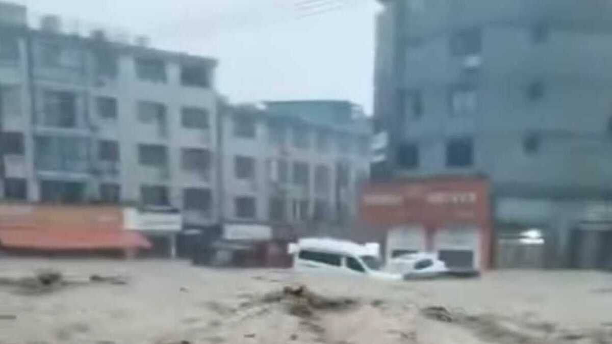
- Typhoon Saudel brought torrential rain and waterlogging to parts of Minhou County in Fujian.
- Emergency teams carried out flood-control, drainage and resident-evacuation operations on 3 September.
- Rescue workers evacuated residents and assisted with household belongings as floodwater affected local communities.

Typhoon Saudel, the 18th typhoon of 2026, made its third landfall in eastern China on Thursday, bringing torrential rain and strong winds to Fujian province and prompting the evacuation of more than 83,000 people.
Saudel made landfall in Zhangpu County, under the city of Zhangzhou in Fujian, at about 6.30am local time, with maximum sustained winds of 23 metres per second near its centre, according to the Fujian provincial meteorological observatory.
The storm's latest landfall came less than a week after it struck Zhejiang province twice on August 28. Its earlier landfalls prompted the evacuation of hundreds of thousands of people across eastern China as authorities prepared for heavy rain, strong winds and flooding.
By 7am on Thursday, more than 83,000 people had been evacuated in Fujian as persistent heavy rain affected parts of the province.
The authorities suspended work, business activities and school attendance in parts of Zhangzhou. Schools were also closed in Fuzhou, Quanzhou and Ningde, provincial authorities said.
Eight sections of major roads had been closed, while 657 transport services were suspended. Work was halted at 152 construction sites and more than 150 major tourist attractions were shut across Fujian.
The province raised its flood-control emergency response level on Wednesday while maintaining its typhoon response.
China's National Meteorological Center issued a blue typhoon alert on Thursday morning. The country's typhoon warning system uses colour-coded alerts, with blue representing the lowest of the four warning levels.
The centre forecast that Saudel would move westwards at 15 to 20 kilometres per hour and gradually weaken.
Flooding and rescue operations
The storm brought torrential rainfall to parts of Fujian, causing waterlogging and triggering emergency drainage and evacuation operations.
In Minhou County, emergency crews evacuated residents from flooded areas in Nanqian Village, while rescuers helped residents move belongings from homes affected by rising water. Aerial images showed roads in Shangjie Town inundated by floodwater, with emergency vehicles moving through affected areas.
The flooding prompted authorities to focus on drainage, rescue operations and the movement of residents from vulnerable areas.
Xinhua reported that local authorities had also carried out rescue and flood-drainage operations in Zhangzhou as heavy rain continued following the typhoon's landfall.
From Thursday afternoon through Friday afternoon, heavy to torrential rain was forecast across most of Fujian, as well as eastern and northern Guangdong, southern Jiangxi, southern Hunan and much of Taiwan, according to the National Meteorological Center.
The widespread rainfall raised the risk of flooding and other hazards in areas already affected by saturated ground and heavy precipitation.
Saudel's unusual path through eastern China
Saudel first made landfall along the coast of Zhejiang on August 28.
According to Xinhua, the typhoon made two landfalls in Zhejiang that day. Its first landfall was recorded at about 8.05am in Yuhuan City, under Taizhou, with maximum sustained winds of 35 metres per second, equivalent to Force 12 winds.
Zhejiang authorities raised the typhoon emergency response to Level I, the province's highest level, before the storm arrived. Measures were taken to ensure that people, vessels and activities were kept away from the sea during the emergency.
After its passage through Zhejiang, Saudel subsequently moved back towards the coast before making its third landfall in Fujian on September 3.
The latest landfall brought the storm further south along China's eastern seaboard, with Fujian bearing the brunt of the rainfall and flooding.
More typhoons expected to affect China in September
Chinese meteorological authorities have warned that Saudel will not necessarily be the last significant tropical cyclone to affect the country this month.
Gao Rong, deputy director of China's National Climate Centre, said two to three more typhoons were expected to make landfall in China or significantly affect the country in September.
Most are expected to affect the eastern and southern coasts, although Gao said there was also a risk that relatively strong typhoons could move northwards and affect northern parts of the country.
Monitoring data showed that 24 typhoons had formed over the north-western Pacific and the South China Sea by September 1, according to the National Climate Centre. That was 10.4 above the historical average for the same period.
Seven of those systems had made landfall in China, 2.1 more than the historical average.
Gao urged authorities in potentially affected areas to closely monitor short-term typhoon forecasts and updated risk warnings, particularly for hazards associated with intense rainfall and strong winds.
These include mountain torrents, urban waterlogging, strong winds and storm surges.
An unusually active summer
The latest storm comes after a particularly active typhoon period between June and August.
According to monitoring data cited by Xinhua, typhoon activity during those three months was accompanied by prolonged and widespread strong winds and heavy rainfall.
China also experienced above-average rainfall and frequent extreme precipitation during the period.
The country recorded 15 widespread rainstorm events, while daily rainfall at 44 national meteorological stations exceeded previous historical records.
The combination of tropical cyclones and extreme rainfall has created repeated risks of flooding across different parts of the country, particularly in areas exposed to intense or prolonged rainfall.
For foreign readers, China's eastern and southern coastline is particularly exposed to tropical cyclones because it faces the north-western Pacific and the South China Sea, where tropical storms frequently develop during the annual typhoon season.
Fujian, Zhejiang and Guangdong are among the coastal provinces regularly exposed to tropical cyclones. Major population centres, transport networks, industrial areas and tourist destinations along the coast can face disruption when storms bring strong winds, storm surges and intense rainfall.
Forecast risks after landfall
Although Saudel was forecast to weaken as it moved inland, authorities continued to warn of heavy rainfall after landfall.
The National Meteorological Centre's forecast covered several provinces and Taiwan, reflecting the broad area potentially affected by the storm's rain bands.
Flooding can continue or worsen even after a tropical cyclone weakens, particularly when rainfall persists over river catchments or mountainous areas. Authorities have therefore continued to emphasise evacuation, drainage and monitoring of vulnerable areas.
As Saudel moves westwards and gradually loses strength, attention is also turning to the next tropical systems that could affect China during September.
The National Climate Centre's forecast of two to three additional typhoons underscores the continued need for coastal and inland regions to monitor weather warnings during the remainder of the typhoon season.