Viral video highlights how peatland drainage has worsened Kalimantan’s fire risk
Indigenous filmmaker Kynan Tegar says decades of peatland drainage for agriculture have left parts of Kalimantan more vulnerable to fire, as Indonesia battles a severe dry-season haze episode.
- Kynan Tegar says drainage canals have transformed Kalimantan’s naturally wet peatlands into landscapes vulnerable to fire.
- The Mega Rice Project illustrates how abandoned drainage infrastructure can leave a long-term fire risk.
- Indonesia is investigating concession areas as fires affect millions of people and send smoke across borders.

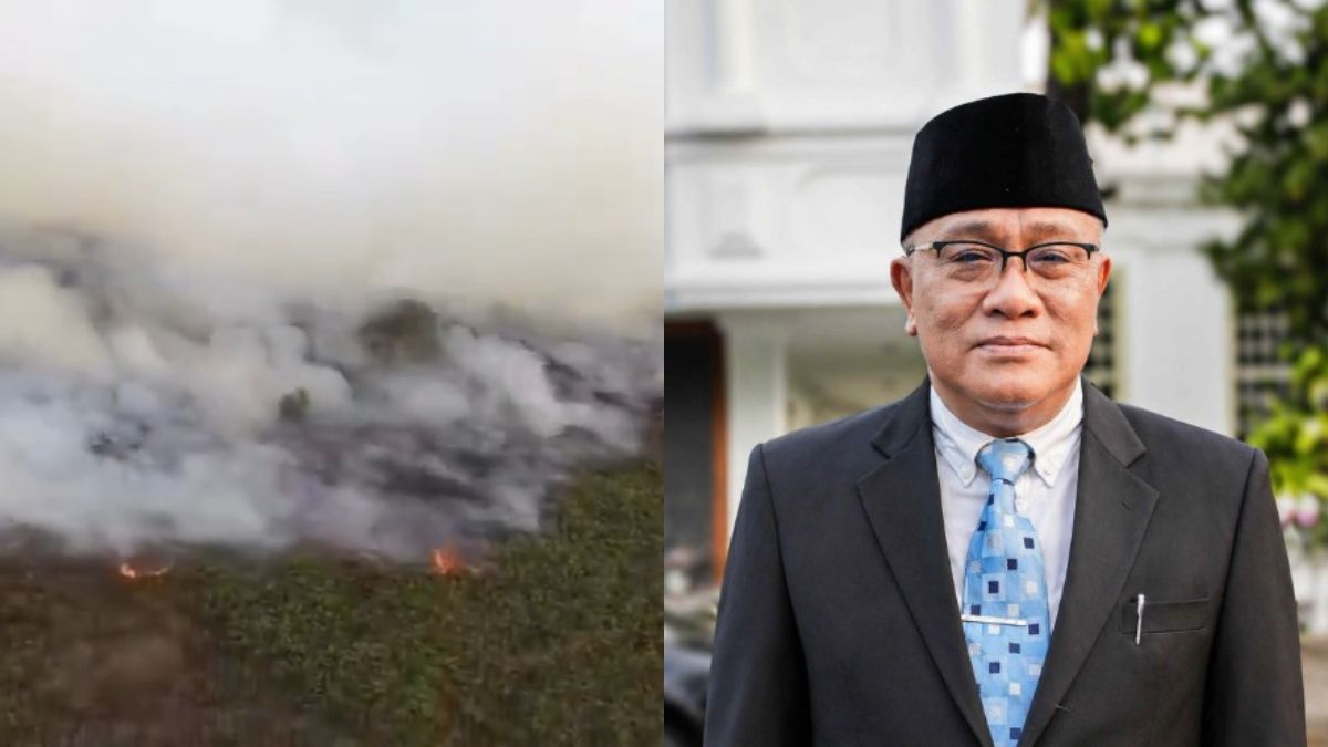
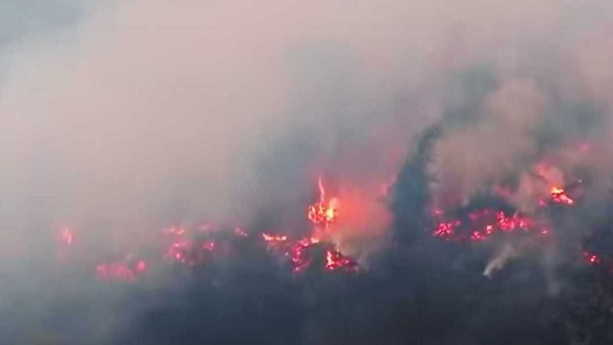
An Indigenous filmmaker from West Kalimantan has drawn attention to the human changes to Kalimantan’s peatlands that she says have left large areas of the island increasingly vulnerable to fire during Indonesia’s severe dry season.
In a video filmed at a fire-affected area in West Kalimantan, Kynan Tegar, an Indigenous Dayak Iban filmmaker and storyteller from Sungai Utik, argues that the fires should not be regarded simply as a natural disaster.
Tegar points to satellite imagery showing what she describes as “impossibly straight lines” running across parts of the landscape, in some cases for hundreds of kilometres. She identifies these lines as drainage canals constructed to remove water from peatlands for agricultural development.
According to Tegar, many of the canals were created in connection with large-scale agricultural projects, including areas developed for palm oil. She also refers to land around Ketapang in West Kalimantan and Palangka Raya in Central Kalimantan, including areas associated with food-estate projects and earlier agricultural schemes.
She describes the changes as the result of decades of large-scale alteration of the landscape. By draining peatlands, she says, people have transformed naturally waterlogged ecosystems into much drier terrain that can burn when conditions become sufficiently dry.
Her comments come as Indonesia confronts a major fire and haze episode across Kalimantan, with authorities deploying additional firefighting aircraft and conducting inspections of concession areas.
What Tegar says the satellite images show
The central feature of Tegar’s video is the network of straight canals that she says can be seen from above.
Peatlands naturally contain large quantities of water. Their soils are made largely from partially decomposed vegetation that has accumulated over long periods under waterlogged conditions. Maintaining a high water table is therefore an important part of preventing peat from drying out and becoming combustible.
Tegar argues that drainage has fundamentally changed that relationship between water and the landscape.
Her video refers to the canals as infrastructure built specifically to dry peatland for agriculture. She says the resulting landscape can remain vulnerable to fire long after the original land-development projects have changed or been abandoned.
The Indonesian government has also been carrying out peatland-wetting operations during the current fire season. Officials have reported situations in which smoke continues to emerge from peat even after visible flames have disappeared, requiring further cooling and wetting to prevent fires from returning.
The legacy of the Mega Rice Project
One of the historical examples relevant to Tegar’s comments is Central Kalimantan’s Mega Rice Project, launched in the 1990s.
The project sought to convert a vast area of peat swamp into agricultural land, particularly for rice cultivation. Extensive canals were constructed to drain the peatlands, but the agricultural scheme failed and was eventually abandoned.
The drainage network nevertheless remained in the landscape.
Dried peat is particularly difficult to fight once it catches fire because combustion can continue beneath the surface. A fire may therefore appear to have been extinguished while smouldering peat remains capable of producing smoke or reigniting.
Tegar refers to this history when discussing what she describes as decades of intentional changes to the landscape.
Her statements about specific projects, companies and the purposes of particular drainage networks are claims made in her video. Separately, Indonesian authorities have been investigating fires within commercial concession areas and imposing sanctions where violations are identified.
View this post on Instagram
Government investigates concession areas
The Forestry Ministry has intensified inspections of concession holders as the fire season worsens.
In late August, authorities said they were inspecting 19 companies in Sumatra and Kalimantan after fires were detected across more than 11,000 hectares within their concession areas. Investigations were being conducted to determine the causes of the fires and whether violations had occurred.
The ministry subsequently announced sanctions against five forest concession holders in West Kalimantan after fires were detected within their concession areas. The measures included licence-related restrictions and orders for environmental restoration.
Earlier, six other concession holders in Kalimantan had also faced administrative sanctions following fires affecting their areas.
The government has said companies can be held responsible when fires occur within their concessions if investigations establish violations of their obligations.
El Niño intensifies fire conditions
The current fires are occurring against the backdrop of a strong El Niño, which has contributed to prolonged dry conditions across Indonesia.
The Forestry Ministry reported hundreds of high-confidence hotspots across Indonesia in early September, with monitoring concentrated on fire-prone areas of Kalimantan and Sumatra. The government has deployed aircraft for patrols, weather modification operations and water bombing.
Indonesia has also received assistance from abroad. Thirty-five foreign-registered aircraft have been approved to support aerial firefighting operations across Kalimantan.
The dry conditions provide a particularly difficult environment for managing peatland fires because underground combustion can continue even when rainfall or firefighting has reduced surface flames.
The impact extends beyond the fire zones
The consequences of the fires have been felt by communities across Kalimantan through deteriorating air quality and respiratory illness.
Indonesia’s Health Ministry has reported that about 5.4 million people across seven provinces have been affected by the current fires and haze. More than 50,000 cases of acute respiratory infection had been recorded by late August, according to government data.
The smoke has also crossed Indonesia’s borders into Malaysia. Air quality in parts of Sarawak has reached hazardous levels as smoke from fires in Kalimantan moved across the region.
Wildlife has also been affected.
An orangutan named Sempurna was found in severely weakened condition in Ketapang, West Kalimantan, after exposure to smoke from nearby fires. She later died. A subsequent examination found abnormalities affecting several organs, with changes in the lungs suspected to be associated with smoke exposure and acute oxygen deprivation.
Tegar’s warning about a changed landscape
For Tegar, the current fires are part of a much longer story about how Borneo’s landscapes have been transformed.
Her video contrasts the natural characteristics of peatlands with the drainage systems that have been constructed across them. She argues that the canals have lowered water levels and created conditions in which peat can dry out and become vulnerable to even a small source of ignition.
Tegar also distinguishes the people living in fire-affected areas from the large-scale projects operating in the wider landscape. In the video, she says local residents do not want their homes, gardens and livelihoods to burn.
Her perspective comes from her own background as an Indigenous Iban filmmaker and storyteller from Sungai Utik, where she has documented Indigenous communities, customary forests and traditional relationships with the land.
As firefighting continues across Kalimantan, the questions raised in Tegar’s video centre on how the landscape reached its current condition — and how drainage, land conversion and decades of development may affect the ability of peatlands to withstand prolonged periods of drought.