Indonesia detects 4,028 hotspots across Sumatra as South Sumatra accounts for nearly three-quarters
BMKG detected 4,028 hotspots across Sumatra on 15 September, with South Sumatra accounting for 2,994 as dry conditions fuelled continued fire risks and haze.
- BMKG detected 4,028 hotspots across Sumatra, including 2,994 in South Sumatra.
- Riau recorded 40 hotspots, with smoke from southern Sumatra contributing to reduced visibility.
- The government was handling 31 forest and land-fire cases across 10 provinces.

Indonesia’s Meteorology, Climatology, and Geophysics Agency (BMKG) detected 4,028 hotspots across Sumatra on 15 September, with South Sumatra accounting for nearly three-quarters of the total.
The BMKG Pekanbaru station in Riau recorded the figures in data updated at 4pm Western Indonesian Time (WIB) on Tuesday, according to forecaster Bella R. Adelia, as forest and land fires continued to affect parts of the island.
South Sumatra had the highest number of detected hotspots, with 2,994, followed by Bangka Belitung with 354, Jambi with 319 and Lampung with 269.
Riau recorded 40 hotspots, while Bengkulu had 32. Other hotspots were detected in West Sumatra (13), the Riau Islands (five) and North Sumatra (two).
Hotspots spread across Riau
The 40 hotspots detected in Riau were distributed across six areas.
Indragiri Hulu recorded the highest number with 24, followed by Indragiri Hilir with seven and Kuantan Singingi with four. Pelalawan recorded three, while Dumai and Rokan Hilir each had one.
The hotspot data was accompanied by reduced visibility in several parts of Riau as haze affected the province.
At 4pm, visibility in Pekanbaru and Rengat was around three kilometres, while it was about 2.5km in Pelalawan and four kilometres in Tambang, BMKG Pekanbaru said.
The agency also detected smoke moving into Riau from areas further south in Sumatra.
BMKG Pekanbaru station head Warjono said wind patterns and satellite imagery indicated that smoke from fires south of Riau was being carried towards the province by winds from the southeast and southwest.
He said the haze affecting Riau therefore was not necessarily generated by fires within the province itself, as smoke could be transported by prevailing winds.
Government reports high-confidence hotspots
The broader BMKG figure differs from the number of high-confidence hotspots recorded by Indonesia’s Ministry of Forestry through its SiPongi monitoring system.
As of 9.05pm on 15 September, SiPongi, using data from NASA Terra/Aqua, SNPP and NOAA-20 satellites, recorded 1,037 high-confidence hotspots nationally, according to the ministry.
Of the six priority provinces monitored by the government, South Sumatra had 245 high-confidence hotspots, followed by Central Kalimantan with 266, Jambi with 62, West Kalimantan with 43, South Kalimantan with 72 and Riau with 15.
The figures are based on different monitoring periods and satellite-based criteria. The Forestry Ministry has previously stressed that a hotspot is a satellite-detected indication of elevated heat and does not automatically mean there is an active fire at that location.
Indonesia strengthens firefighting operations
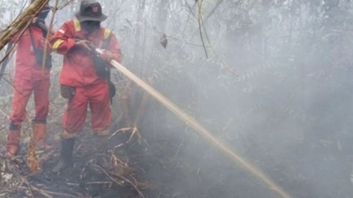
The Forestry Ministry said it was continuing land and aerial operations to control forest and land fires, including ground firefighting, water bombing, aerial patrols and weather modification operations.
On 15 September, the ministry said it was strengthening its response following an increase in high-confidence hotspots, particularly in Kalimantan. It said dry conditions were contributing to the risk of fires and allowing fires, particularly on peatland, to persist.
The ministry said 81 per cent of Indonesia’s seasonal zones had entered the dry season during the 15–21 September period, while 1,637 observation points had recorded more than 60 consecutive days without rain.
Despite the dry conditions, BMKG forecast moderate rain in parts of West and Central Kalimantan between 15 and 17 September.
The government has also been pursuing legal action against parties suspected of causing forest and land fires.
On 15 September, the Forestry Ministry said its law-enforcement directorate was handling 31 cases across 10 provinces involving a combined affected area of 3,625 hectares.
Of those cases, 22 were under investigation, seven had entered the formal investigation stage and two had been handed to prosecutors.
The ministry has urged communities and businesses not to clear or open land by burning, and asked residents to report smoke, fires or suspected burning activities to authorities.