El Niño expected to intensify into very strong event, WMO says
El Niño is firmly established in the tropical Pacific and is expected to strengthen into a very strong event by late 2026, raising risks of drought, flooding and extreme heat worldwide.
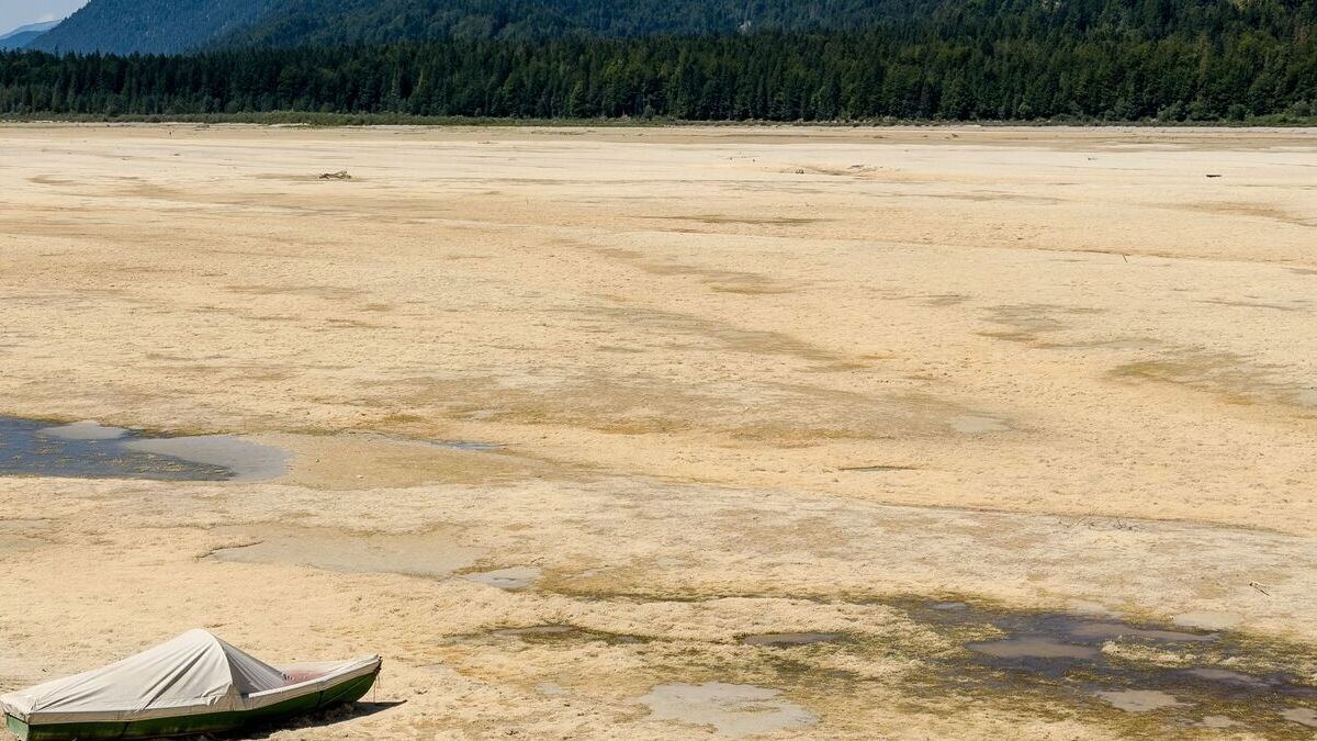
- El Niño is expected to intensify further and peak towards the end of 2026.
- The WMO expects the event to persist through February 2027 with exceptionally high certainty.
- Indonesia and other regions face changing rainfall patterns alongside heightened risks from heat, drought and flooding.

El Niño has become firmly established in the tropical Pacific and is expected to intensify into a very strong event in the coming months, bringing major shifts in rainfall and temperature patterns and increasing the risks of drought, flooding and extreme heat, the World Meteorological Organization (WMO) said.
In its latest El Niño/La Niña Update, published on Thursday, the WMO said there was an “exceptionally high likelihood of nearly 100%” that El Niño would persist through February 2027. It said this was the first time one of its El Niño/La Niña updates had expressed such a high degree of certainty.
The event is being fuelled by exceptionally warm waters across the central and eastern equatorial Pacific. Forecasts indicate that El Niño will strengthen further before reaching its peak towards the end of 2026, with its effects on global climate expected to continue into 2027.
UN Secretary-General António Guterres said the latest developments came as countries were already experiencing extreme weather.
“El Niño is being supersized before our eyes,” Guterres said. “The science leaves no room for doubt: the planet is in uncharted waters, and those waters are heating up.”
Exceptionally warm Pacific Ocean
El Niño is a naturally occurring climate pattern and one of the two phases of the El Niño-Southern Oscillation (ENSO), with La Niña representing the opposite phase.
It is characterised by unusually warm sea-surface temperatures in the central and eastern equatorial Pacific. Changes in the tropical Pacific can alter atmospheric circulation and influence rainfall and temperature thousands of kilometres away.
El Niño events generally occur every two to seven years and last between nine and 12 months. They commonly begin developing between March and June and reach peak intensity between November and February. Their influence on global temperatures can be strongest in the year following their development.
The latest event developed rapidly during 2026. In July, WMO forecasts indicated that El Niño was intensifying towards a strong event, with the seasonal average sea-surface temperature anomaly for August–October projected at about 2.9°C in the key monitoring region.
By mid-August, the positive sea-surface temperature anomalies across the central and eastern equatorial Pacific had become persistent and were continuing to intensify.
The Niño 3.4 index, a widely used measure of sea-surface temperature anomalies in the central-eastern equatorial Pacific, averaged 1.5°C above normal from May to July and reached 2.0°C above normal in July. Weekly values subsequently rose to approximately 2.2°C to 2.6°C above average between late July and mid-August.
Temperatures beneath the surface were even more unusual, with some areas of the tropical Pacific more than 8°C above average during July and early August.
Global rainfall and temperature shifts
The WMO said a very strong El Niño would increase the likelihood of significant changes in temperature and rainfall patterns across many parts of the world.
For September to November 2026, its multi-model forecasts show an increased likelihood of above-normal temperatures across almost all land areas. Rainfall patterns are expected to display a pronounced response associated with the strong Pacific El Niño.
However, the WMO stressed that a stronger El Niño does not automatically mean more severe impacts in every country.
The effects depend on location, season and the interaction of El Niño with other climate drivers. This means some regions may experience substantially wetter conditions and flooding, while others face suppressed rainfall and drought.
The WMO's July outlook identified a classic El Niño rainfall pattern, with wetter conditions expected in some areas and increased drought risk in others. It also warned of increased wildfire risk in some regions.
Indonesia and the Indian Ocean
The developing El Niño is particularly relevant to countries around the Indian Ocean and Southeast Asia because its effects can interact with another major climate driver, the Indian Ocean Dipole (IOD).
The WMO expects a positive IOD phase to develop during September–November, with a seasonal mean value of about 0.9°C. The equatorial Atlantic is also expected to remain generally warmer than normal.
El Niño is typically associated with reduced rainfall in Indonesia, although the exact effects vary according to the timing and strength of the event and other atmospheric and oceanic conditions. WMO notes that El Niño can bring drought conditions to Indonesia and parts of southern and eastern Asia because of changes in rainfall patterns.
The combination of climate drivers means national and regional meteorological agencies need to assess local forecasts rather than relying on the global El Niño signal alone.
Risks of extreme heat
El Niño generally has a warming influence on global temperatures. The WMO said the developing event was occurring against a background of exceptionally warm global land and ocean temperatures.
The strong El Niño of 2023–24 contributed to a temporary additional warming effect on top of the long-term warming trend caused by greenhouse gas emissions. WMO has previously said that the combined effect contributed to 2024 becoming the warmest year on record.
The organisation warned that the effects of the current El Niño could continue after the event reaches its peak.
WMO Secretary-General Celeste Saulo said communities were already experiencing disruption from droughts and floods and expected those impacts to increase as El Niño strengthened.
“El Niño in Spanish means boy child – but it has the potential to deliver a massive blow to communities and economies across the world,” Saulo said.
No ‘super El Niño’ classification
Although the latest event is forecast to become very strong, the WMO does not officially use the term “super El Niño”.
Its operational classification describes ENSO events as weak, moderate, strong or very strong. The organisation says “super El Niño” is not part of its standard classification system.
The WMO has also cautioned that the intensity of an El Niño event alone cannot be used to determine the severity of weather impacts in a particular location.
Other climate patterns, including the IOD and conditions in the Atlantic Ocean, can reinforce, weaken or alter the typical effects of El Niño.
Preparing for the months ahead
The latest forecast has prompted the WMO and national meteorological and hydrological services to increase preparedness and early-warning activities.
WMO said reliable seasonal forecasts can give governments, humanitarian agencies, businesses and communities time to prepare for changes in rainfall and temperature.
Forecast information is particularly important for climate-sensitive sectors including agriculture, health, energy and water management. It can be used to anticipate drought, flooding, heat stress and other hazards, and to support decisions on water resources, crops and emergency preparedness.
Saulo said the organisation was undertaking a major mobilisation with national meteorological and hydrological services in response to the expected event.
“Never before in the 50-year history of the World Meteorological Organization have we launched such a major mobilization,” she said.
The WMO said its forecasts would continue to be updated as the El Niño event develops. More detailed assessments of local conditions will come from national meteorological agencies and WMO regional climate centres.
The latest outlook indicates that El Niño is expected to peak towards the end of 2026, remain in place through February 2027 and continue influencing global temperatures and weather patterns beyond its peak.